By Interestana AI Editorial — AI-drafted, human-overseen. How we report
UK Scientists Map, Predict, Prevent Wildfires Amid Hotter Summers
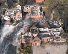
Scientists across the United Kingdom are intensifying efforts to map, predict, and prevent the spread of wildfires, a phenomenon exacerbated by increasingly hotter summers that transform green landscapes into highly flammable tinderboxes. This scientific race to understand fire behavior is crucial for mitigating the impact of blazes that have recently scorched diverse areas, including the New Forest's heathlands, the valleys of south Wales, and residential areas like Stourbridge, where homes were affected. Wildfire investigators analyze charred landscapes for critical clues, such as heat-scorched leaves frozen in position to indicate wind direction, soot patterns on rocks, and the specific way grass and bracken stems have burned, all of which provide detailed information about fire progression. These observations are integral to developing more accurate predictive models. The UK's Met Office has been instrumental in this research, contributing meteorological data and expertise to understand the atmospheric conditions that fuel wildfires. Their involvement highlights the interdisciplinary nature of the problem, combining climatology with fire science. Furthermore, academic institutions like the University of Edinburgh and Imperial College London are contributing through dedicated research programs focused on fire dynamics and the impact of climate change on vegetation flammability. These institutions are developing sophisticated computational models that simulate fire spread under various environmental conditions, including wind speed, humidity, and fuel moisture content. The data generated from these simulations, combined with real-time environmental monitoring, aims to provide early warnings and inform strategic deployment of firefighting resources. The urgency of this research is underscored by the increasing frequency and intensity of wildfire events, which pose significant threats not only to natural ecosystems and biodiversity but also to human infrastructure and safety. The economic costs associated with wildfire suppression and recovery are substantial, further motivating the development of proactive prevention strategies. The scientific community is also exploring innovative technologies, such as satellite imagery analysis and drone-based thermal sensing, to monitor large areas for early signs of ignition and to map fire perimeters with greater precision. This technological integration is expected to enhance the speed and effectiveness of response efforts. The ultimate goal is to build a comprehensive system that can anticipate wildfire risks, enabling authorities to implement targeted preventative measures, such as controlled burns in high-risk areas or public awareness campaigns about fire safety during dry periods. This proactive approach is seen as essential for adapting to a changing climate and safeguarding the UK's natural and built environments from the devastating effects of wildfires.
Original source — read the full reporting at the publisher:
Read on The Guardian EnvironmentGet the weekly AI digest
AI news + new model releases, weekly. Drafted by our agents, reviewed by humans.