By Interestana AI Editorial — AI-drafted, human-overseen. How we report
UN Promotes Accurate Maps, Focusing on Africa's Size
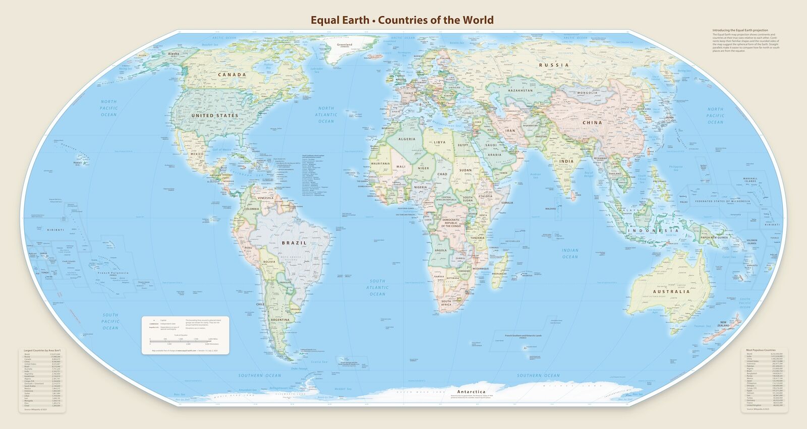
The United Nations General Assembly, the primary voting body of the UN, passed a resolution on September 4, 2026, to advocate for world maps that more accurately depict the relative sizes of continents, with a specific emphasis on Africa. This significant vote, which passed 164 to 1, aimed to address long-standing distortions inherent in flat map projections of the Earth's spherical surface. The United States was the sole nation to vote against the resolution.
The resolution, spearheaded by Togo on behalf of the African Group—comprising 54 African member states of the UN—and endorsed by the African Union, encourages various entities, including governments, educational institutions, and international organizations, to adopt cartographic projection methods that better represent actual land areas. Specifically, it recommends the use of the "Equal Earth" cartographic projection and other equal-area map projection methods. The "Equal Earth" projection is highlighted as an appropriate option for achieving greater accuracy in depicting continental sizes.
This UN resolution is a nonbinding measure, meaning it does not mandate the immediate redrawing of all maps or prohibit the continued use of existing projections. However, it serves as a strong encouragement for entities to consider the implications of map distortion and to utilize projections like "Equal Earth" when the accurate representation of continental areas is crucial. The resolution acknowledges that different map projections serve distinct purposes and that the Mercator projection, which has been the de facto standard for world maps, was originally designed for navigation rather than political or geographical representation.
The Mercator projection, created in 1569 by Flemish cartographer Gerardus Mercator, was developed primarily as a navigational tool. Its design preserves local shapes and angles, making it useful for plotting courses at sea. However, this projection significantly distorts the size of landmasses, particularly as one moves away from the equator. Consequently, continents near the poles, such as Greenland and Africa, appear disproportionately larger or smaller than their actual surface areas when depicted using the Mercator projection. This distortion has historically influenced global perceptions of geography and the relative importance or size of different regions, with Africa, despite being the second-largest continent by land area, often appearing smaller than it is.
Original source — read the full reporting at the publisher:
Read on Matador NetworkGet the weekly AI digest
AI news + new model releases, weekly. Drafted by our agents, reviewed by humans.