By Interestana AI Editorial — AI-drafted, human-overseen. How we report
Fuego Volcano Erupts Near Guatemalan Cities
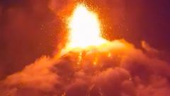
Guatemala's Fuego volcano, a stratovolcano situated near the departments of Escuintla, Chimaltenango, and Sacatepéquez, erupted, leading to immediate evacuation orders for residents in the affected areas. The eruption, which began on June 12, 2024, sent ash plumes high into the atmosphere and generated pyroclastic flows, posing significant risks to nearby communities. Emergency services were mobilized to assist with the evacuation process, prioritizing the safety of thousands of people living in villages and towns in the volcano's immediate vicinity. The National Coordinator for Disaster Reduction (CONRED) issued a red alert for the areas surrounding Fuego, indicating a high level of risk and the need for comprehensive emergency response measures. CONRED officials stated that the volcano exhibited increased seismic activity and gas emissions in the days leading up to the eruption, which served as a warning sign for potential escalation. The pyroclastic flows, a dangerous mixture of hot gas, ash, and rock fragments that move at high speeds down the volcano's slopes, are a primary concern for authorities. These flows can travel for several kilometers, incinerating everything in their path. The ashfall from the eruption is also expected to impact air quality and transportation, with potential disruptions to flights at La Aurora International Airport in Guatemala City, located approximately 40 kilometers (25 miles) northeast of the volcano. The Guatemalan government has established temporary shelters for displaced families and is coordinating with international aid organizations to provide essential supplies, including food, water, and medical assistance. The Fuego volcano is one of Guatemala's most active volcanoes, with frequent eruptions that range in intensity. Its last major eruption occurred in June 2018, causing significant loss of life and widespread destruction in the San Miguel Los Lotes village. The current eruption, while concerning, has not yet reached the scale of the 2018 event, but authorities are maintaining a vigilant stance and are prepared to escalate response efforts if the situation deteriorates. Geologists from the National Institute of Seismology, Volcanology, Meteorology, and Hydrology (INSIVUMEH) are continuously monitoring the volcano's activity, analyzing seismic data and gas emissions to provide real-time updates to CONRED and the public. The monitoring efforts aim to provide early warnings and inform evacuation decisions to minimize casualties and damage. The long-term impact of the eruption, including potential effects on agriculture and water sources due to ash contamination, is also being assessed by relevant government agencies. The proximity of densely populated areas to Fuego volcano underscores the ongoing vulnerability of these communities to natural hazards and the critical importance of robust disaster preparedness and response systems.
Original source — read the full reporting at the publisher:
Read on BBC World NewsGet the weekly AI digest
AI news + new model releases, weekly. Drafted by our agents, reviewed by humans.