By Interestana AI Editorial — AI-drafted, human-overseen. How we report
Spokane Wildfires: 600 Structures Lost, Thousands Evacuated as 7,700 Acres Burn Uncontained
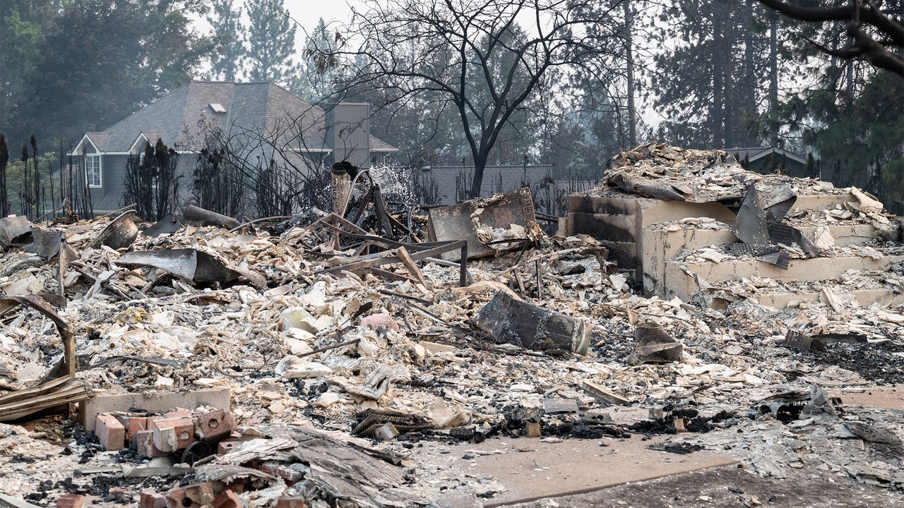
A series of three devastating wildfires, collectively designated as the Spokane Complex Fire, has inflicted significant damage on eastern Washington, impacting the region surrounding Spokane, the state's second-largest city. As of Monday morning, these fires remained entirely uncontained, having already consumed an estimated 7,700 acres of land. The destruction has been extensive, with approximately 600 structures lost and thousands of residents forced to evacuate their homes. The complex is comprised of three distinct fire incidents: the Old Trails Fire, the Fairview Fire, and the Autumn Lane Fire. Spokane, strategically located in the eastern part of Washington near the Idaho border, is a vital urban center for the region. Mayor Lisa Brown, speaking at a news conference on Sunday, characterized the ongoing situation as "the worst natural disaster our region has faced," underscoring the severity of the crisis. In response to the escalating threat, a substantial firefighting effort is underway. By early Monday, nearly 900 firefighters and other emergency personnel were actively engaged in efforts to gain control over the blazes. The origin of these fires is currently under investigation, with the cause yet to be determined. Fortunately, as of the latest reports, no injuries have been sustained by residents or emergency responders. To aid the public in monitoring the rapidly evolving situation, several valuable resources have been made available. WFCA.com, a platform associated with the Western Fire Chiefs, offers a sophisticated mapping tool. This tool leverages data from authoritative sources such as NASA and NOAA to provide a real-time snapshot of the fires, including critical details and a "threat score" for each incident. The nonprofit organization Watch Duty provides a dedicated app and mapping tool that delivers up-to-the-minute information on evacuation orders, the locations of local shelters, and essential details regarding the personnel involved in the firefighting operations. Furthermore, the Wildfire Aware app, powered by the renowned spatial analytics company Esri, allows users to search for and meticulously track any active wildfire across the United States. This application provides granular data, drawing from authoritative entities within Esri's ArcGIS Living Atlas, enabling a detailed understanding of fire locations and their spread. These tools are crucial for keeping affected communities and concerned individuals informed during this critical wildfire event.
Original source — read the full reporting at the publisher:
Read on Fast CompanyGet the weekly AI digest
AI news + new model releases, weekly. Drafted by our agents, reviewed by humans.