By Interestana AI Editorial — AI-drafted, human-overseen. How we report
UN Resolution on Map Projections Unlikely to Alter Navigation Apps
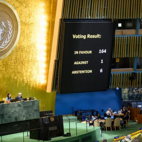
On September 4, the United Nations General Assembly passed a resolution, spearheaded by African nations, advocating for the use of map projections that more accurately represent the relative sizes of continents. The resolution garnered 164 votes in favor, with six countries abstaining. Notably, the United States voted against the resolution, with UN News reporting that the U.S. delegation characterized it as a "radical ideological project." Despite this significant international endorsement, the widespread adoption of alternative map projections by popular navigation applications is considered unlikely. Millions of users are accustomed to the Mercator projection, a 16th-century world map that distorts the size of landmasses, particularly near the poles, making equatorial regions appear smaller and polar regions disproportionately larger. For instance, Africa, which is the world's second-largest continent by land area, appears smaller than Greenland on a standard Mercator map, despite Greenland being roughly 14 times smaller than Africa. Similarly, South America appears smaller than North America, though South America is larger. The UN resolution is non-binding, meaning it does not legally compel any entity to change its mapping practices. Instead, it "encourages governments, schools, international organizations, and technology companies to use the Equal Earth projection and other so-called equal-area maps when relative size matters," according to UN News. The resolution also promotes educational initiatives to inform the public about the inherent trade-offs involved in representing a spherical planet on a flat surface. The Equal Earth projection, developed by Bojan Šavrič, Tom Patterson, and Bernhard Jenny, is one such equal-area alternative that aims to minimize distortion in both area and shape, presenting a more geographically accurate depiction of the world. However, the inertia of user familiarity and the established infrastructure of existing mapping services present significant hurdles to widespread change. Technology companies often prioritize user experience and familiarity, and a sudden shift to a less familiar projection could lead to confusion or user dissatisfaction. The practical implications for navigation, such as calculating distances or understanding relative geographical scales, are central to the debate. While equal-area maps offer greater accuracy in representing landmass sizes, the Mercator projection's advantage lies in its ability to preserve local shapes and angles, making it useful for navigation where rhumb lines (lines of constant compass bearing) are straight. The UN's call for greater accuracy in representing continental sizes highlights ongoing discussions about cartographic bias and the historical context of mapmaking, which has often reflected colonial perspectives. The resolution's encouragement for educational efforts aims to foster a more critical understanding of maps as representations rather than perfect replicas of reality. Nevertheless, the practical integration of these principles into widely used digital platforms remains a complex challenge, dependent on technological feasibility, user acceptance, and the willingness of major navigation app providers to invest in significant changes to their foundational mapping systems.
Original source — read the full reporting at the publisher:
Read on Ars TechnicaGet the weekly AI digest
AI news + new model releases, weekly. Drafted by our agents, reviewed by humans.